Student Stories
Heather Sauerland
GIS graduate
Geospatial technologist
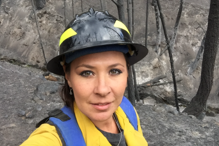
As a geospatial technologist for a 3D data-gathering firm, Heather Sauerland spends her days working with reality capture technologies, using drones, laser scanners, and 360-degree aerial photography to collect and present information for a diverse client list. It might be a vineyard-mapping project one week, then a 3D scan of a complex staircase the next, and then a plant-regrowth monitoring project in a wildfire zone. It's a far cry from her former career in the food and beverage industry — but a great choice for this science-minded, outdoorsy person who's something of a map fanatic.
"I came to understand that a map can be even more than displaying locations. With layered data, we can attempt to understand things like how humans behave, where government assistance is most needed, and where natural disasters might hit the hardest."
"I've always been drawn to maps," says Sauerland. "In fact, for many years my wall artwork was maps — until I needed to grab a particular map for a hike."
With her GIS studies, Sauerland began to view maps — and their impact — in a whole new light. "I came to understand that a map can be even more than displaying locations. With layered data, we can attempt to understand things like how humans behave, where government assistance is most needed, and where natural disasters might hit the hardest."
At COCC, regular class visits from working GIS professionals helped make an impact. Hearing from people like government workers and Red Cross personnel demonstrated to Sauerland that her new academic interest could lead to a meaningful new career, not just a job. "It helped me see how GIS can, and does, have a real effect in the world," she adds. That maps can be difference-makers. "A truly compelling map is one that not only draws the eye, but provokes thought and potentially sparks change."
Sauerland received COCC's one-year GIS Certificate of Completion.
Mapping projects created by Heather Sauerland - click to enlarge
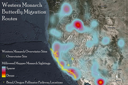
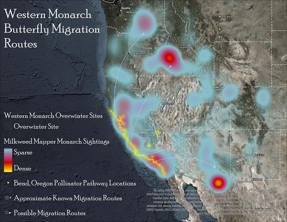
Map of Monarch Butterfly Migration
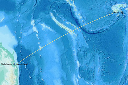
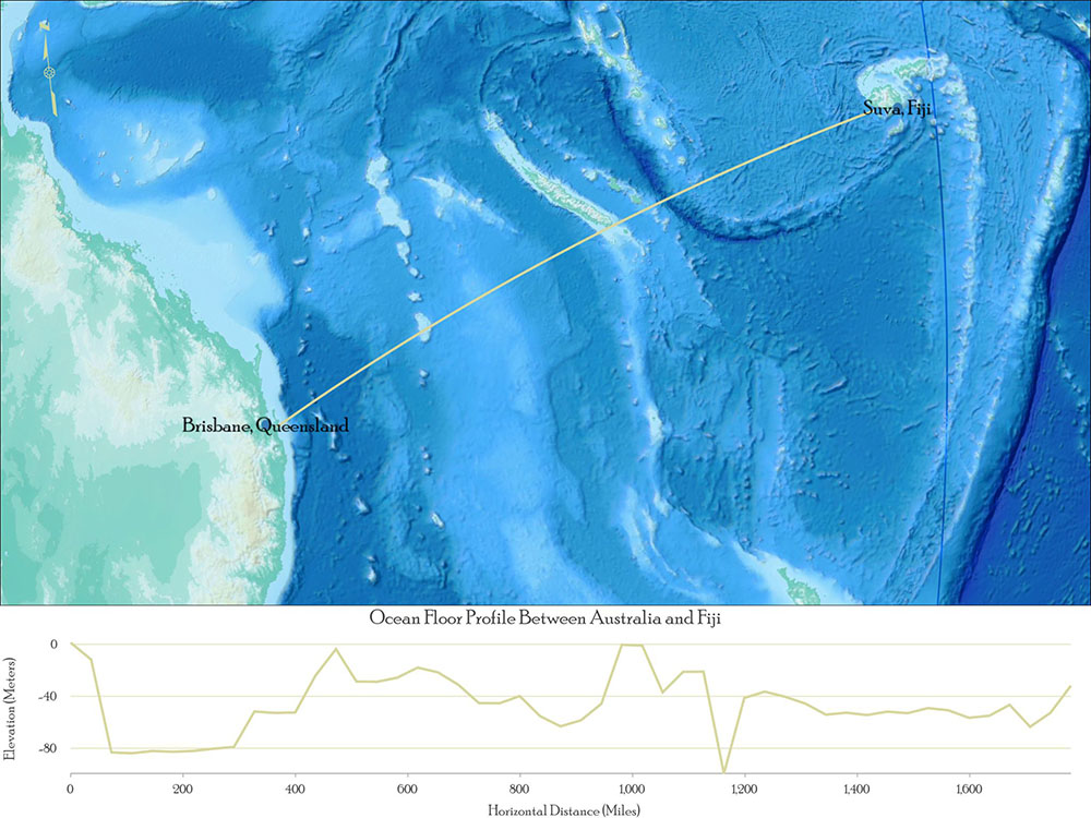
Map of Ocean Floor between Australia and Fiji
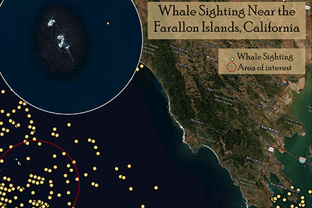
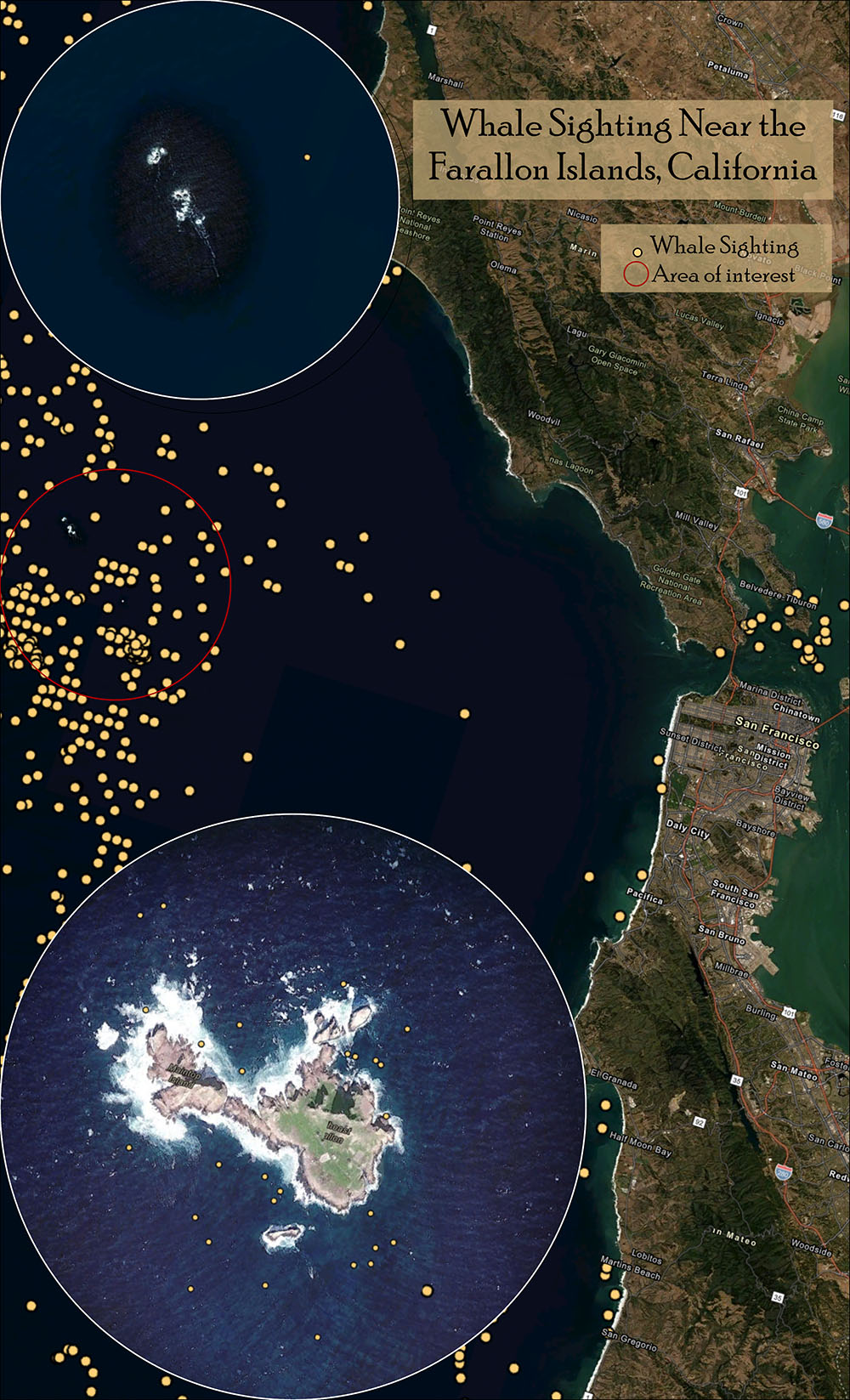
Map of Whale Sightings Near Farallon Islands, CA
Trisha Johnson
GIS graduate
GIS analyst
Trisha Johnson traces her career back to an experience she had with pictographs and petroglyphs. As an intern with the Museum at Warm Springs, she helped record Native American rock art using mapping technology, a fascinating project that led her to COCC and ultimately into her profession. Of course, having a mother who worked as a GIS analyst made an early impression, too.
"With real-life learning experiences, they made it fun but also true to real-world situations."
"She would have us digitize book pages or pictures on the large-format digitizing board and plot them on the pin plotter before we could color them," Johnson recalls of those childhood moments, when coloring time often came with a techy approach.
At COCC, she appreciated how instructors presented information in an applicable way. "With real-life learning experiences, they made it fun but also true to real-world situations," she says.
Having worked as a GIS analyst and data collection specialist for both the Confederated Tribes of Warm Springs and the Confederated Tribes of the Colville Reservation, Johnson is deeply involved in the national Burned Area Emergency Response program, which prescribes and implements post-wildfire treatments, such as replanting. "It helps minimize threats to life or property and to stabilize and prevent further damage to natural and cultural resources," she says. "It's about protecting lives, infrastructure, and critical cultural and natural resources." And it's where GIS and stewardship go hand in hand.
Johnson received both the Associate of Applied Science degree and Certificate in Geographic Information Systems.
Taylor Monroe
GIS graduate and former COCC GIS tutor
Cartographer, Benchmark Maps
“I’ve found that even though GIS is rooted in science, it leaves room for me to express that creative side,” explains Monroe, whose affinity for the material led her to become a program tutor. “The more time I spent doing GIS, the more I realized that was what I was supposed to be doing. It has a lot to do with problem-solving, using maps and spatial analysis to solve real-world problems.”
“The thing that first impressed me about the instructors at COCC was their genuine dedication to getting to know their students,” Monroe adds. “You could tell that they really wanted you to succeed. Every instructor I had clearly loved what they did and that really made a difference to me.”
After graduating with an Associate of Applied Science degree in GIS, Monroe was hired as a cartographer for Benchmark Maps, based at their Medford office. Her work utilizes mapping and design software to help create and edit atlas pages, folded maps, and custom print maps.
“I enjoy the challenge of researching and designing maps that are both accurate and visually appealing,” she says. “I think print maps are often overlooked and seen as outdated, but working at Benchmark I get the opportunity to show that they’re not just a thing of the past.”